The Phoenix Suns are in the playoffs for the first time since 2010. In the intervening years – no, the unending feeling playoff drought, the team has changed substantially. The 11 year cycle of despair and disappointment has brought change; a lot of it. The Suns have had six coaches and a different leader in win shares nearly every season. Only over the last few seasons has the roster stabilized around Devin Booker, who was for a period, the only good thing the Suns had to offer. Even their home in Downtown Phoenix has undergone noticeable change, from traditional sponsors to a sponsor that was somehow named for a place that was not the arena to a total renovation with no sponsor whatsoever, the arena is basically all new. I could go on about how much the franchise has both altered itself and its trajectory, but suffice it to say that very little in Phoenix has changed as much as the Suns between 2010 and today.
Well, except for Downtown Phoenix, which will be hosting playoff basketball once again.
Downtown Phoenix as rendered by Google.
Here I’ll show you some of what has changed and why the Downtown Phoenix that you’ll see if you’re headed to the game or watching on TV is nothing like the one that played host to the 2010 Suns. From new skyscrapers to an unrecognizable Roosevelt Row to the undeniable impacts of the light rail, there’s a lot to discover, so let’s dive in.
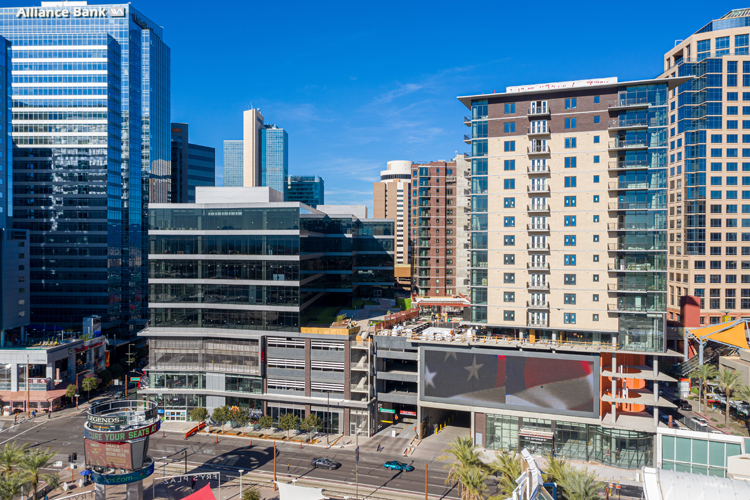
The first and most obvious difference is directly across Jefferson St. from the arena. Block 23 as it is known, has been home to Phoenix City Hall, a movie theater, JCPenny, fallout shelter, and by 2010, a surface parking lot. In the grand Phoenix tradition, the old was bulldozed for the new, and then the cycle began again (check out this good summary from several years ago). In 2017, Red Development, the team behind CityScape next door, broke ground on a new development that took Block 23 from surface parking to a dynamic, urban mixed use space. Now complete, it has Downtown Phoenix’s first and only grocery store and 330 units of housing, all steps from the arena. With Block 23 built upon, the Suns’ urban arena suddenly feels much more urban.
The Block 23 development, just across from the arena.
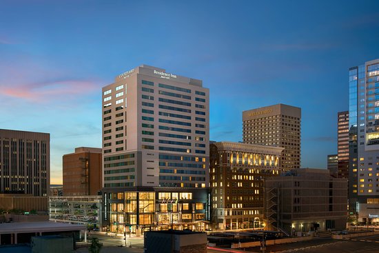
But it’s not just Block 23 that has a new high rise near the arena. Just a block away on Central Ave., a dual-branded Marriott hotel, home to the excellent Litual Rituals bar, opened in 2017. In addition to this property, Marriott also opened an AC by Marriott property at the Arizona Center this year. And the hotels don’t stop there! A 11-story Hampton Inn & Suites opened next to Arizona State University’s Downtown Phoenix campus in 2018, just five blocks from the arena.
Courtyard / Residence Inn by Marriott, just a block from the arena.
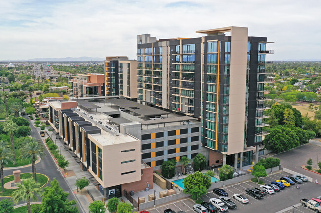
Hotels are wonderful, but a major growth sector for Downtown Phoenix has been multifamily housing. In addition to the 330 units I mentioned earlier, several projects have either been completed or have broken ground in the 11 years that the Suns have lived in the playoffless wasteland. Perhaps the most exciting development for Downtown Phoenix, which was once a handful of office towers and little else, housing means that there is a year-round liveliness that was lacking before the residents (and ASU) came.
Portland on the Park in the northern reaches of Downtown Phoenix.
I want to start with what’s under construction currently, because perhaps the most noticeable difference between 2010 today is the sheer abundance of cranes! According to Downtown Phoenix Inc., there are currently 11 housing developments, either mid-rise or high-rise, in Downtown Phoenix. This amounts to 3,433 units, which, in raw terms, is A LOT. The most notable of these, at least in terms of skyline alteration, are X Phoenix and phase two of the Link. X Phoenix will be a 20-story, 253 unit building when complete, while phase two of the Link will be 25-stores and 204 units.
X Phoenix, as rendered.
While several notable housing developments have changed the Phoenix skyline, I’d like to focus on two here that have come about in the last handful of years: The Stewart and The Link (phase one). The Stewart, at Central Ave. and McKinley St., opened in 2019 and rises 19 stories. It represents a northward push for towers in Downtown Phoenix and is hard to miss as you cross Hance Park into Downtown Phoenix on Central Ave from the north. To the east rises the Link, a 30-story tower with 252 units. The Link stands out as the most north and east high-rise – at least until phase two is complete.
Phase one of the Link, which will ultimately include three towers.
There are a ton of other mid-rise projects that have been built or are under construction now, but suffice it to say that Downtown Phoenix is booming. I didn’t even get into the renovations, retail developments, or entertainment venues here either. There’s a reason for that though. Plenty of sources, including the irreplaceable Downtown Phoenix Inc., have chronicled the growth of the area. What’s more important than the growth, however, is the feel. Streets that were once dead are now full of life, connecting previously isolated sections of Downtown Phoenix. This means that for pedestrians, the most important of all urban travelers, Downtown Phoenix is far more accommodating, entertaining, and engaging. It keeps you walking and makes you want to explore, stay, spend, and live in Phoenix’s urban core.
A crowd in Downtown Phoenix with the ever present cranes in the background.
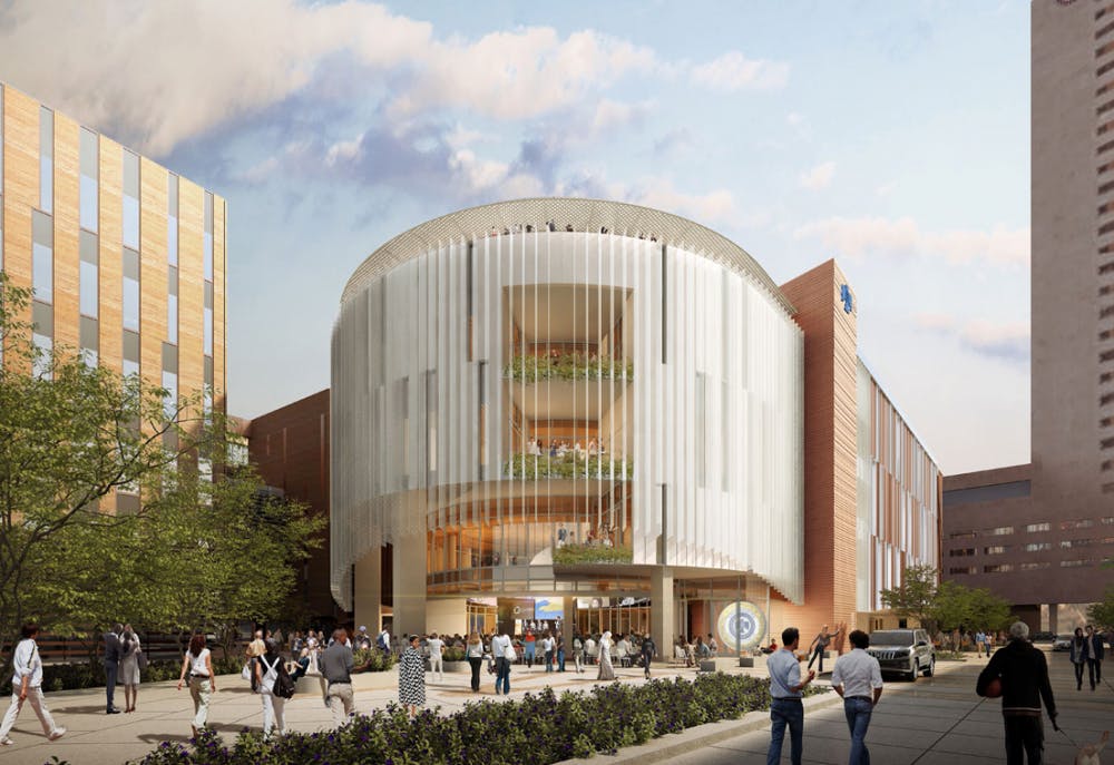
I would be remiss if I didn’t mention the impact of Arizona State University in more detail. Currently building a 16-story dorm next to Civic Space Park, ASU has contributed buildings and students to Downtown Phoenix in a way that has catalyzed other investment. They’ve taken over the Mercado and built new buildings at the Phoenix Biomedical Campus (which has grown in its own right, thanks to every major Arizona university). ASU is also building its new Thunderbird School of Global Management building in Downtown Phoenix, adding yet more to its footprint. Now, ASU was there before the Suns last made the playoffs, but they have built a lot since then as well.
A rendering of the Thunderbird School of Global Management at ASU’s Downtown Phoenix campus.
It has to be noted that there is so much more that I could not get to here. From Roosevelt Row to the areas near 7th Avenue, the City and others have invested a lot in making Downtown Phoenix work. As somebody who works in the downtown world, I know that these things take a long time to pay off. It takes the government, and activists, and community will, rather than a new General Manager, a point guard, and actual NBA players. And not unlike the rebuilding of the Suns, reinvigorating a downtown takes time, even if there isn’t a timeline.
All this is to say that, for many, the first glimpse of Downtown Phoenix they will see in many years will be on the NBA broadcast this Sunday. And I think what they’ll see will surprise them. So let’s beat LA this series and hope that the Suns playoff fortunes will turn around, because I can’t wait for the championship parade through Downtown Phoenix.
Sources for this story include: Basketball Reference, This Could be Phoenix, ARMLS, ABC 15, Hotel News Resource, The Arizona Republic, AZ Big Media, Downtown Phoenix Inc., Curbed, Red Development, Arizona State University, and the Phoenix Business Journal.
I took a day trip up to Prescott last weekend and as I was driving back, I started thinking about how we experience rural Arizona. Often, I think, we see rural Arizona from the Interstate or a large, fast highway designed to get you from point A to point B as quickly as possible. These roads bypass the small towns that the old highways connected, leaving us with less of an appreciation for what makes this state special. Don’t get me wrong, Arizona’s big highways are uniquely beautiful – the crests and valleys of the 17 especially so – but if possible, I think you should take the back road. Let me explain why by taking you on a journey along two of my favorite roads in Arizona.
Between Kirkland and Skull Valley on Yavapai County Road 10
Prescott is a favorite weekend getaway for Phoenicians. From its cooler temperatures to its charming downtown to its relative proximity, it’s easy to see why so many people make the trek up from the valley. In my experience, the most common way that folks get up to Prescott is via Interstate 17 and State Highway 69. I get why – it’s the fastest and easiest way to get to Prescott from Phoenix. But there is a better way. I now almost exclusively take the back way.
So what is the back way to Prescott? Well it’s really more like 1 ½ back ways, if I’m being honest, because while a majority of the route is shared, as you approach Prescott two options present themselves. The beginning is as follows for both: follow US 60 from Phoenix to Wickenburg and then take US 93 from Wickenburg to the junction with AZ 89. Once you’ve climbed the mountain and travel through the valleys, you have your choice of ways to get to Prescott – either AZ 89 straight through or County Road 10.
From Phoenix to Kirkland Junction
With that foundation laid, let’s talk about the first leg – the US 60 to Wickenburg. This heavily trafficked corridor also leads to Las Vegas, so you’re probably familiar with it. That said, I highly recommend stopping in Wickenburg’s absolutely adorable downtown. As US 60 turns into the US 93 it bypasses Downtown Wickenburg, so it’s quite possible you’ve missed it. But we’re not here to spend much time on Wickenburg – it’s a lovely place, but it’s also pretty well known.
Downtown Wickenburg
As you take the turn onto AZ 89 near Wickenburg Ranch the traffic immediately thins and the desert opens up around you. Save for the occasional house, the first community you’ll encounter is Congress. There’s not much to see in Congress these days – but it has a pretty interesting history. The settlement that came with the Congress Mine, it is one of countless rural Arizona communities that emerged from the early days of mining.
Gold was discovered near congress in 1884, leading to the creation of the Congress Mine. The mine was active until the 1930’s, producing roughly $400 million worth of gold in today’s dollars during that period. In 1893, less than a decade after the discovery of gold, the Santa Fe, Prescott, and Phoenix Railway served the area. The rails are still active as the BNSF branch line to Phoenix. Unfortunately, much of the original Congress settlement is gone and what you see today is at the site of the former Congress Junction.
Congress Mine and Mining Camp
From Congress, the road turns northeast and approaches a spectacular wall of mountains. If you’re a fan of driving, this is where this route gets good. As you near the mountains, the road begins to climb and climb through beautifully contoured switchbacks that make for an excellent stretch of road. Paired with the stark contrast provided by the view of the desert below, it truly is one of my favorite pieces of asphalt in the state. It doesn’t hurt that the road climbs about 1,300 feet in about 4 miles either.
Looking down on Congress from State Highway 89
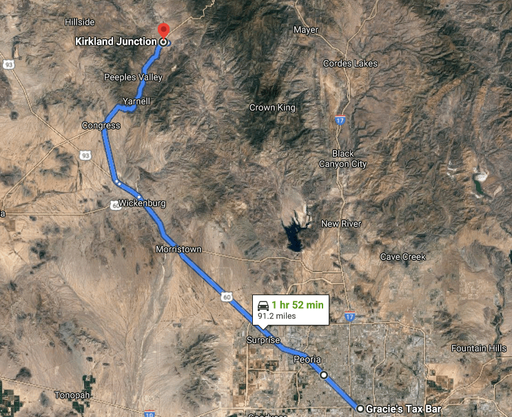
As you summit the mountain, you’re dropped into Yarnell, which is nestled in a small valley. Yarnell is, like Congress, a surviving mining town. Yarnell has fewer than 1,000 residents, and was founded to serve the Yarnell Mine. I can’t find much information about the Yarnell mine, but in recent history, the town is known for the tragic Yarnell Hill Fire, which killed 19 firefighters. There is a monument to these hotshots on the mountain near the town.
Main Street, Yarnell
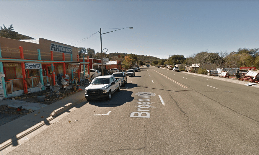
From Yarnell, you travel through the lush ranches of Peeple’s Valley. Passing through these agrarian landscapes reminds of what Arizona, and especially Phoenix, was once full of. It’s the kind of landscape that you’ll want to roll the windows down for so that you can take in all of the beauty. Named for AH Peeple’s, a prospector who discovered gold somewhat nearby, Peeple’s Valley, like the other towns on this drive, has a connection to mining.
Ranches in Peeple’s Valley
About 11 miles from Peeple’s Valley, at Kirkland Junction, you encounter your choice of ways to get to Prescott. Let’s turn down County Road 15 toward Kirkland and then turn right at the BNSF railroad track, which we’ll have crossed several times already and will cross again. As an aside, that the majority of this journey runs with the rails is something that enhances the experience significantly for me, as there’s something I find quite romantic about a freight train trundling alongside you as you drive through an empty expanse of rural Arizona. Or, in this case, as you pass through a little draw with a creek bed separating you from the rails.
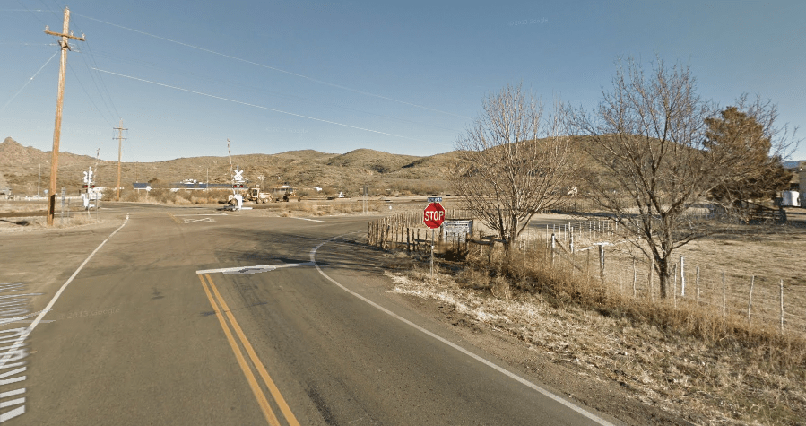
Kirkland – turn right for Skull Valley
You emerge from the draw into Skull Valley, a picturesque agrarian community of approximately 800 people. It has its own school district, post office, and is located along the same rail lines that we’ve passed before. Like Peeple’s Valley before it, Skull Valley is throwback to the agrarian roots of Arizona, a real time warp in a way. It’s easily one of the most beautiful places in Arizona. From Skull Valley, the road winds through more gorgeous Arizona country before entering Prescott on the northwest side of town.
Skull Valley and the BNSF rail
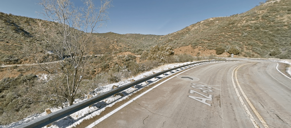
Returning to Kirkland Junction, this time we’ll continue on AZ 89 towards Wilhoit. Now, Wilhoit is a small rural town, just on the other side of the mountains from Prescott. Though there are only 16 miles between them, it feels as though they are worlds apart because the natural environments are so different. Additionally, though 16 miles is shorter than my daily commute to work, it takes about 30 minutes to from Wilhoit to Prescott, because AZ 89 again returns to being a series of switchbacks and hairpin curves – the kind of technical road that a driver loves.
Hairpins and elevation changes on State Highway 89 near Prescott
All in, taking the back way(s) to Prescott adds about an hour to your journey, but what it lacks in efficiency it more than adds in beauty, exploration, and appreciation for what makes Arizona so wonderful. From sudden changes in environment to beautiful semi-isolated rural agrarian communities to interesting history, the back way(s) to Prescott provide a journey that is rich with the nostalgic magic of the road trip.
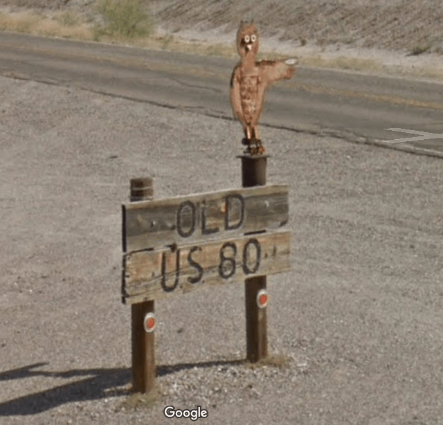
So now that we’ve explored the back way(s) to Prescott, I’d like to come back to Greater Phoenix – or at least Greater Phoenix by the standards of the Greater Phoenix Economic Council. We’ll be exploring how we get back to Phoenix from Gila Bend. For those that have driven to San Diego from Phoenix, the route you’ve likely taken is some combination of freeways, interstates, and State Highway 85 between the valley and Gila Bend. While that is undoubtedly the fast way to do it, I am here to tell you that it is not the best way. Instead, let me recommend Old US Highway 80 and MC 85 that eventually becomes Buckeye Road in Phoenix. And, as before, to explain why, I’ll take you through the journey.
A helpful sign in Gila Bend
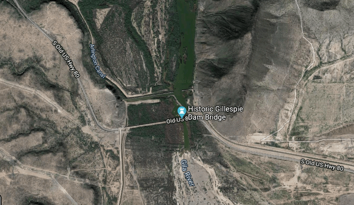
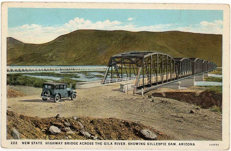
Starting from Gila Bend, Old US Highway 80 runs virtually parallel to State Highway 85 on the west side of the Gila Bend Canal. As you head north, Old US Highway 80 meanders through some of gorgeous agricultural landscapes before winding west to cross the Gila River. Here, we encounter our first true marker of this highway’s past: the Historic Gillespie Dam Bridge. We’ll explore the history of both the dam and the bridge below.
Crossing the Gila River on Old US Highway 80
The Gillespie Dam was built by Frank Gillespie, a local rancher, and opened in 1921. It stood at 80 feet tall and spanned 1,700 feet and formed the Gillespie dam reservoir. It’s design was not like what you might see at Glen Canyon Dam in Page, but rather allowed water to overflow the dam when it rose to that level. Now, you’ll notice that I wrote the past several sentences in the past tense. I did so because in 1993 the dam failed during a major weather event, and was never repaired. What you’ll see along Old US Highway 80 today is more or less how the dam was immediately after its failure.
Gillespie Dam before the bridge was built
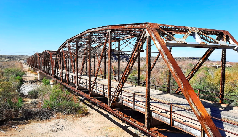
As you might imagine, very near to the Gillespie Dam is the Gillespie Dam Bridge, which was opened in 1927. Unlike the dam, the bridge still stands and is open to traffic. Interestingly, prior to the bridge’s construction, then US Highway 80 simply crossed the Gila River at the base of the Gillespie Dam, meaning that during storms, vehicles could struggle to cross. As an aside, I always find the early US Highways fascinating, simply because of how much more difficult traversing the United States was in the earliest days of the automobile. With this in mind, it should be no surprise that the bridge is remarkably narrow, with no pedestrian access on either side (not that it would really be necessary, if we’re being honest). The bridge was constructed with steel and was restored in 2012. There also appears to be some sort of historic information plaza, complete with parking, at the east side of the bridge, but when I last visited the bridge in 2020, the plaza was more or less destroyed.
The Gillespie Dam Bridge depicted in its early daysA recent photo of the Gillespie Dam Bridge
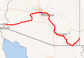
It’s here that I want to take a moment to provide some background information on US Highway 80 for context. US Highway 80, known as the Ocean-to-Ocean highway, ran from San Diego, California to Tybee Island, Georgia. In Arizona, it ran from Yuma to Phoenix and back through Tucson – effectively Interstate 8 to State Highway 85 to Interstate 10 – before heading south to Tombstone before meeting the New Mexico state line. It’s worth noting that much of the tarmac that made up US Highway 80 in Arizona is still in use under some other designation. I highly recommend reading the entire wikipedia article on it and spending some time on Google Earth to see what’s left: https://en.wikipedia.org/wiki/U.S._Route_80_in_Arizona
US Highway 80 as it traversed Arizona
Returning to Old US Highway 80 on the west side of the bridge, the road continues to run alongside the beautiful green fields along the Gila River, before eventually bending back to the east in Arlington. There isn’t much to see in Arlington, but the scenery is lovely and it’s always interesting to see another small town. From Arlington, you can take Old Highway 80 to the current day State Highway 85 highway, but it doesn’t connect, so I’d recommend cutting over to MC 85, which will take you to Downtown Buckeye. You should stop in Downtown Buckeye and walk around, because it has a really interesting feeling of being both a part of the Phoenix metro and still quite rural.
Downtown Buckeye
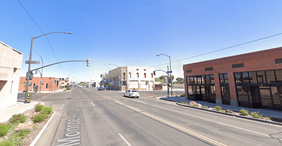
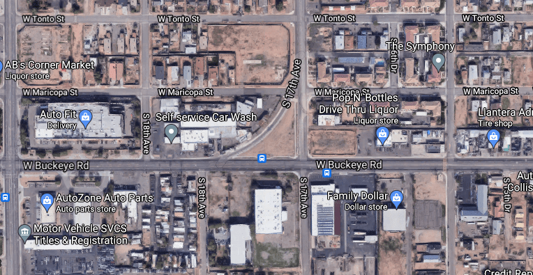
Stay on MC 85 and you’ll pass through a long swath of the remaining farmland in metro Phoenix and little agrarian towns like Liberty. You’ll also run alongside the Gila River for portions again, lending a natural beauty to the drive. As you approach Cotton Lane in Goodyear, you’ll suddenly find yourself back in civilization, near large warehouses, manufacturing, and other light industrial sites. Continuing on, you’ll eventually wind up near Phoenix Goodyear Airport, where MC 85 curves again and becomes Buckeye Road – aptly named, I’d say. I wrote earlier that a lot of US Highway 80 was still around under a different name, so it should come as no surprise that this entire portion of road was once a part of the highway. As we continue east, the road becomes less scenic, passing through what I’ll call distribution alley – a hive of trucks and trailers – before crossing Interstate 17. Soon after crossing the 17, US Highway 80 turned north on 17th avenue, where a physical remnant of the road remains today. If you read my write up on US 60, you’ll know that the Mill Avenue curve near ASU was a remnant of the old highway alignment. Here on 17th avenue, you can see that a similar curve exists.
17th Avenue and Buckeye Road today17th Avenue and Buckeye Road 1949
As US Highway 80 headed north on 17th Avenue, it passed directly in front of the old State Capitol building before meeting Van Buren, where it turned east to stack with the US 60 (hello, old friend), at Grand Avenue. And because it joined there, this is where our journey will end.
Following the path of Old and now decommissioned Highway 80 is undoubtedly a longer, slower, and more cumbersome way to get from Gila Bend to Phoenix. But what should make it undesirable as a route actually has the opposite effect. This road transports you back in time, showing the roots (pun intended) of the valley in their agrarian glory. You’ll drive through history on the Gillespie Dam Bridge and see how the valley has transformed into the metropolis it is today – all on one road. Ultimately, this route is worth the trip because of how it moves you, not because of how you move on it.
This brings me to my final thought on why you, as an adventurous Arizonan, should take the back road. These roads put you back in touch with Arizona as it once was, which can in turn give you a greater appreciation of Arizona as it now is. The serene agrarian or desert landscapes they pass through can be a perfect canvas for your thoughts. They can show you why, in a very physical sense, early miners and ranchers came to Arizona in the first place and show you what happens when industry dies. And more than anything else, they can remind you why you love living in Arizona in the first place when the City becomes overwhelming. They certainly do that for me.
Sources for this include Wikipedia, MrZip66, Google Maps, Tucson.com, Maricopa County Historical Aerials, and Gila Bend, AZ.
This is lightly modified from a Twitter thread that covered the same topic.
With the MLB season right around the corner, I thought that this week would be the right one to look at some of the lost stadiums around Phoenix & beyond. The Arizona desert has long been a haven for sports, so those shown here are just a fraction of the Phoenix’s lost stadiums.
As always, we’ll take a look at what these stadiums were, who they were for, and why they’re now gone. Stadiums generally have a shorter lifespan than other buildings – a dynamic that tied into Phoenix’s lax attitude (until recently) toward historic preservation.
Let’s start with Compadre Stadium (1986-2014), which was located in Chandler. As you might have guessed from the photo below, Compadre was the Milwaukee Brewers Spring Training home from 1986-1997. It had a capacity of approximately 10,000.
Compadre Stadium was built to help Chandler get a piece of the Spring Training pie, ultimately luring the Brewers from Sun City. The City was much smaller in the 1980’s, with less than 30,000 residents in 1980 – so as you’ll see below, there wasn’t much around the ballpark.
The ballpark was quickly surpassed in amenities by its peers and the Brewers asked that the City invest $10+ million in the stadium to improve it. Chandler attempted to fund improvements via a bond election, but it failed. As a result, the Brewers left for Maryvale in 1998.
After the Brewers left, the ballpark sat vacant for nearly two decades, eventually being demolished in recent years. Interestingly, Compadre Stadium was the first to offer grass lawns for seating beyond the outfield wall – an essential feature of Spring Training today.The stadium site is now home to a housing development, the Snedigar Sports Complex, Snedigar Recreation Center and Snedigar Park. Chandler has added 200,000+ residents since the ballpark was built, so it’s no surprise that the area looks quite a bit different today.
For our next subject, we’re going to look at a stadium that was demolished soon after Compadre opened. Montgomery Stadium (1927-1987) was a football stadium located in Downtown Phoenix. Below, you can see it in the upper portion of this image from 1930.
Montgomery Stadium is probably best known for hosting the Salad Bowl from 1948-1955. Sponsored by local Kiwanis clubs, it was a college football bowl game from 1948-1952, before hosting other games from 1953-1955. ASU (2x) & UofA played in Salad Bowl, winning none between them.
The stadium had a capacity of 23,000 and was part of the Phoenix Union High School (PUHS) campus – now part of the Phoenix Biomedical Campus. The stadium was stood where ASU Prep is currently located at 7th St. and Polk. Here’s an aerial image of the stadium from 1930 next to PUHS.
Montgomery Stadium was, quite frankly, a weird stadium. With only one large grandstand, it had and unusual layout. Perhaps more interestingly, the one grandstand was really, uh, grand! Even as it was facing demolition, its beauty wasn’t lost.
From Downtown Phoenix, we’ll head west to explore a now-demolished horse racing track: the Phoenix Trotting Park. Now, if you ever drove west on Interstate 10, you probably know this structure. And I’d guess, you probably, like me, have wondered what it was.
Opened in 1965, the Trotting Park closed for good in 1966. Despite its limited use, the large concrete grandstand wasn’t demolished until 2017. It could hold more than 12,000+ spectators, but rarely did. And that, plus construction costs nearly 4x expected, sunk this ship.
It’s location almost certainly didn’t help matters. The photo in the previous tweet is from 1969 – after the track had already closed. If we zoom out, we’ll see that the Phoenix Trotting Park was far from basically everything. Of note, there was no I-10 at that time.
I think at this point, I should clarify exactly where this structure was. It sat at what’s now the junction of the 303 and I-10, so if it was built today, it may have had a fighting chance. But as we can see below, even in 1986 -20 years later- there still wasn’t a lot out there.
Ultimately, the Phoenix Trotting Park is more a curiosity than a place that was full of history. It’s a story of the ambition and optimism of Phoenix in the 1960’s – even if it was a failure. If you want to know more about it, I recommend visiting https://phoenixtrottingpark.com. Finally, we’ll head south to Casa Grande to bring this thread full circle. Unlike the other stadiums in this thread, much of this complex remains and has taken on a new life. That’s right, we’re going to visit Francisco Grande, once the Spring Training home of the San Francisco Giants.
Developed by Horace Stoneham, owner of the Giants, Francisco Grande opened in 1961. It featured a 3,000 seat ballpark, 4 practice fields, and, oh yeah, a full-service high-end resort. Get this, the resort had – and still has – a pool shaped like a baseball bat.
The ballpark is now gone, but the resort still stands. It’s located west of Casa Grande on AZ 84 and features a large sports training complex as well as a golf course. It underwent renovations in 2003 to bring it back to life. You can see it today in the photo below.
Wait, what’s that on the left of the image above? Is that an abandoned airfield? Of course it is. Though not in use anymore, Francisco Grande had an unpaved runway that was used in its early days, with a taxiway to the resort. This place really had it all.
The Giants ended up leaving Francisco Grande in the early 1980’s for Scottsdale, where they still play today. As I mentioned above, Francisco Grande is still a sports training facility – now home to the Barcelona FC US Residential Soccer Academy.
As always, there’s so much more history for each of these than I could cover here – and there are many more stadiums that have been lost along the way. But I hope that this sparks your curiosity and maybe brings back fond memories.
Sources: Wikipedia, The Arizona Republic/AZCentral, Francisco Grande Resort, Stadiumpostcards .com, San Francisco Giants, Salt River Stories, Phoenix Trotting Park .com, Ballpark Digest, Flickr, http://Chandlerpedia.org, Maricopa Historical Aerials, Airfields-Freeman & Google Maps.
This is lightly modified from a Twitter thread that covered the same topic.
You know of Sun City. But have you heard of Circle City? Halfway between Sun City & Wickenburg, it was intended to be for members of the Workmen’s Circle, a quasi-socialist Jewish organization. We’ll explore it’s history in this thread, though we may end with more questions than answers.
See, even after spending hours and hours researching Circle City, I still have a lot of questions. Unlike other dives I’ve done, there’s no clear narrative here – no neat ending. There were lots of references to it in old Jewish News editions, but no photos. There were announcements about the plan for Circle City, but very little about it’s progress. And after a few years, it stops showing up in the Jewish News or other papers completely. What’s detailed here is what I could cobble together, though it’s almost certainly incomplete. I want to make it clear that Circle City still exists today – it’s not some ghost town. People live there. In fact, I drove out there to see it myself and it’s very much a living place. This is important to remember as we go through its history. Anyway, let’s dive in.
So where is Circle City? As I mentioned, it’s about halfway between Sun City and Wickenburg, right off US 60. You’d miss it completely if you weren’t looking for it (I have many times) because it is pretty isolated. You can see an aerial image of the location below.
Now that we know where it is, it’s time to explore the story of Circle City. As mentioned, it was intended to be a retirement community for members of a quasi-socialist Jewish org called the Workmen’s Circle. Let’s talk a bit about who they are. The Workmen’s Circle (now The Workers Circe) is a Jewish organization focused on social & economic justice. I call it quasi-socialist because in the org’s early days (1900’s-1930’s), it was pretty openly supportive of socialist ideas. By the 1960’s, this had more or less faded away.
At its peak in the 1920’s, the org had over 80,000 members. Eventually it had hundreds of chapters around the United States, including in Phoenix and Tucson, though its total membership was slowly declining. As of 2010, it had about 10,000 members. It is still active today. In approximately 1957, the group announced that the it intended to build a retirement community for its members in Arizona. Caring for the aged was nothing new for the org and with the rise of places like Youngtown, master-planned retirement communities were suddenly fashionable. You’ll notice I didn’t say it intended to build in Phoenix. Interestingly, it appears that there was a genuine competition between Phoenix and Tucson for the development. You can get a sense of that from this December 1957 article from The Arizona Post, the Tucson Jewish paper.
In a January 1958 blurb from The Arizona Post, you can see that the Tucson group wined and dined the org’s national leaders as part of that effort. During my research I didn’t find any similar stories about a Phoenix effort. At least Tucson didn’t send a saguaro back then.
Ultimately, in 1958, the project was announced for the site Northwest of Phoenix. As we’ll see, this shouldn’t have been a surprise because of the man charged with developing the site, Ben Schleifer. In fact, some accounts credit him with pushing for the idea to Workmen’s Circle.
Who is Ben Schleifer? As it happens, he developed Youngtown, the first master-planned retirement community, located Northwest of Phoenix. Born in 1901, Schleifer was Jewish and came to the US from Russia when he was 13, later moving to Arizona in 1947. He’s on the left in the photo.
That Schleifer was involved makes Circle City’s story so much more interesting to me. Here’s a visionary developer attempting to push the boundaries of what his initial concept could accommodate. And as we’ll see, he may have pushed a bit too far with Circle City. Circle City broke ground in 1958 on 240 acres. While homes were intended for members of the Workmen’s Circle, they were not restricted to them, and were offered to all races and religions. The project planned to have a health club, pool, and other amenities.It was supposed to have anywhere between 500-1,000 homes, depending on the report you read. Homes started at $7,200. It was age-restricted to those 50 and older. And, surprise surprise, it was laid out in a circle. Below, you can see the original plat map for the site.By 1960, about 40 homes were built on the site. The “City” elected a Mayor and was hosting out of town guests. It had a community center of sorts and civic organizations. It even had a Synagogue, which is now a residence. You can still see the menorah on the side of the building.As a fun side note, take a look at the names of the streets. Notice anything? They’re all named for famous or important Jewish figures. Okay, back to the 1960’s. After 1960, it appears that very little new happened on the site. No new homes were built, though Circle City was still advertising to potential residents. In the early 60’s it was mentioned occasionally in the Phoenix Jewish News, but it stopped appearing by about 1964.
This is where the story gets murky to me. Based on the historical aerial below, it appears that even as late as 1976, little, if any, construction had happened at Circle City. There’s no story I can find about it failing, no neat ending. It just sort of disappears from records.
In many ways, it’s like people just stopped caring about Circle City. As I mentioned before, I couldn’t find any photographs of the place or the people from that period. The pool and commercial spaces were never built. Did it run out of money? Was it to far away? Why did it fail? Perhaps failure is too strong of a word, because as you can see in the aerial below, it has built out quite a bit between 1976 and today. As I said, it’s not some abandoned ghost town. We saw plenty of people there during our visit. The park is even maintained.
So Circle City lives on, though not as it was originally intended. It failed as a Jewish retirement community, to live on as an isolated, growing subdivision. In fact, it appears that yet more of the site is going to be developed. This sign was posted while we were there.
There’s a Surprise (literally) twist to this story in modern times too. Circle City had a water company. It drilled a well in 1968 and had an allotment of Colorado River water. In it’s final iteration, that company was creatively called the Circle City Water Company (CCWC). In May 2018, the City of Surprise (see, I told you it was literal) asked its voters if it could acquire the Circle City Water Company, increasing the City’s share of Colorado River water from 3.4 to 4.6 billion gallons. That’s a big deal for a growing city.
Also, consider that the CCWC, which had fewer than 200 customers at the time, had roughly 35% of the allotment of Surprise, which was orders of magnitude larger. It’s interesting that, of all the legacies of the community, its the water company that remains the most relevant. Voters approved the acquisition, but it appears that a developer near Lake Pleasant sued. See, that developer made a deal with CCWC to use its water before the Time of Shedding and Cold Rocks. The potential sale of CCWC to Surprise through it’s water source into limbo. I’ll be honest, it’s not 100% clear to me if Surprise has been able to acquire Circle City Water Company yet. I can tell you that as of February of this year, an article appeared in the Arizona Capitol Times referencing it, but it’s behind a paywall, so I can’t read it.
It seems fitting then, that like the rest of the story of Circle City, I don’t have all the answers about the water company.
I still want to know more about Circle City. I want to know about the people that moved there, what life was like, and why it (sort of) failed. It represented the optimism of that era, when the open desert and the car represented endless possibility and opportunity.
Ultimately, as a Jewish person, as frustrating as it was to not be able to find all the answers through researching this, I enjoyed being able to read the pages of the Phoenix Jewish News and see what life was like for Jews in the Valley that era. The paper had a great logo too.
If you know more about Circle City, I’d love if you’d share. I still have so many questions.
Sources for this thread include: The Phoenix Jewish News, The Arizona Post, The Arizona Memory Project, The New York Times, The Youngtown Historical Museum, Maricopa County Assessor’s & Recorder’s Offices, Maricopa County Historical Aerials, City of Surprise, The Arizona Republic, Circle City Water Company, Google Maps, and HistoricImages dot com.
This is lightly modified from a Twitter thread that covered the same topic.
This week I want to cover a subject that I am working on writing about in greater length: the 1989-1991 United States Formula 1 Grands Prix, which took place on a street circuit in Downtown Phoenix.
It feels like these races have been largely forgotten in Phoenix, save the occasional Arizona Republic article asking “Was there really a Formula 1 Grand Prix in Phoenix?” Admittedly, it’s hard to imagine the fastest cars & drivers in the world racing on the streets of Downtown Phoenix.As you may be noticing, Downtown Phoenix looked a little different 30 years ago. Sans many of the buildings we know today, it looks sparse and frankly un-downtownish. It’s a testament to the effort of the City to Phoenix and grassroots leaders that Downtown has come so far since.While the story of the growth of Downtown Phoenix over the last 30 years is a tremendous one, the story of the races that took place there is perhaps even more interesting. I’ll explain more later, but here’s a clue: the 1989 race was held on June 4. It was 97 degrees. You might ask: “Who in their right mind would plan a race in Phoenix on June 4?” Well, they didn’t! Phoenix was awarded the race when the original host, Detroit, fell through. In fact, Phoenix only signed a contract with F1 in January, less than 6 months before the race. Interestingly, Phoenix had been planning to recruit a major race as an economic development tool. It’s a longer and more complicated story than this has time for, but the race was exactly what Phoenix wanted, albeit on slightly shorter notice than expected.
Okay, let’s talk about the races themselves. Remember, these were street circuits, so they built a track on the streets of Phoenix. You can see the 1989 circuit below and suffice it to say, such a track could not be built in Downtown Phoenix today.
The starting grid for the 1989 US Grand Prix was littered with legends of the sport. Drivers like Ayrton Senna, Alan Prost, Nigel Mansell, Nelson Piquet, and Gerhard Berger all took part. However, one name not listed here has perhaps the most interesting connection to this race.That driver is Eddie Cheever. See, Eddie Cheever was actually born in Phoenix and this race came in his last season. Poetically, he finished on the podium – his last podium ever – in his home town. Here, you can see him in his Arrows-Ford car in action.Despite the heat, more than 30,000 fans attended the race. Alan Prost won the race, with Ricardo Patrese in 2nd, and Cheever in 3rd. Ayrton Senna had the fastest lap, but was forced to retire with electrical problems. Check out a news report on the race:
Smartly, the 1990 race was moved from June to March. The more comfortable temperatures didn’t do much to help the crowds though, as estimates have it topped out at 15,000 – less than half of the prior year’s number.Though fewer fans were in attendance, this was an absolutely epic race and was voted as the best United States Grand Prix by F1 fans in 2015. Ayrton Senna and Jean Alesi battled all race, with Senna taking the win. Here’s a great recap of the race:
You’ll note that in the video linked in the last tweet, the voiceover refers to the Phoenix circuit as brutal. That’s no joke, the roads were rough, sending sparks flying from the cars throughout the race. Even more so, the barriers lining the track were unforgiving concrete.
The podium had Senna in 1st, with Alesi in 2nd and Thierry Boutsen in 3rd. The prior year’s winner, Alan Prost, was forced to retire from the race. I have no reason to be nostalgic for a race that happened before I was born, but I would have loved to have seen this race.The third and final year of the Phoenix US F1 Grand Prix was 1991. Held in March once again, the 1991 race featured a slightly different street circuit, seen here. You’ll notice that this photo isn’t a screencap – I was given a copy of the 1991 program (thank you MJ)!This race featured many of the greats that had taken part in years prior: Senna, Prost, Alesi, Piquet. It also marked the debut of future World Champion Mika Hakkinen. Hakkinen, along with more than half the field, was forced to retire from the race.Another great race, this was voted the 3rd best United States Grand Prix in the same F1 poll that the 1990 race was voted the best. Though this did not feature much competition for first, the battle for second was fierce, with Prost eventually making an terrific pass to take it. The final podium had Senna in 1st again, with Prost in 2nd and Picquet in 3rd. Sadly, attendance was so poor that this race marked the last US F1 Grand Prix until 2000, with F1 deciding to replace it with a race in South Africa.
It seems, however, that I am not the only person who is nostalgic for the races that took place in Downtown Phoenix. Look for the mural of Ayrton Senna, located at Central & Buchanan. It was commissioned by @ericsch89 and as far as I know, is the only tribute to the race in town.
It’s not entirely clear why the race failed in Phoenix. Maybe it was that people couldn’t be bothered to make the drive to Downtown. Maybe it was that the first race was too hot. Maybe Phoenix just wasn’t ready. Whatever the reason, the crowds didn’t show and the race left. I think it’s that the race was so poorly attended that has left it adrift in the history of Phoenix. Certainly, that was a different era, but it’s an incredible moment in the Valley’s history that probably will never happen again. I hold out hope for Formula E race in Downtown Phoenix. Anyway, I hope to write a book about Phoenix in this era that centers on these races. It was such a weird time in the Valley, with so many somewhat forgotten moments like this. Thanks, as always for reading!
Sources include: Wikipedia, Getty Images, DeviantArt, Simanitis Says, Formula 1, ESPN, Rick DeBruhl, The Observer, New York Times, and Ayrton Senna dot com.
This is lightly modified from a Twitter thread that covered the same topic.
Last time I went down the research rabbit hole, I shared some of the history and current conditions of US 60 through metro Phoenix. It’s only fitting to look at where they test the cars for which highways like US 60 were built. Today we’re exploring Proving Grounds around Arizona.
Arizona has a lot of proving grounds, so we won’t get to all of them here. But we’ll look at some notable ones, some that have been shuttered, and answer some questions about these facilities. Why Arizona? Because the Arizona desert is great for hot weather testing far from prying eyes. The first stop on our tour is the Toyota Arizona Proving Grounds (TAPG). Shown in the first tweet in this thread, in the photo below you can see that while it’s isolated, the never-ending growth of the Phoenix metro is slowly encroaching on the site.Opened in 1993, TAPG has a high-speed oval, an off-road testing course, a helipad, and several other facilities. You can see those below in this map from Toyota’s website. The point of these facilities is to push a vehicle to its breaking point and TAPG is no exception.Relative isolation is important to these facilities, as they are testing pre-production or not yet announced vehicles. As urban growth starts to encroach on these facilities, companies look for new, farther afield locations. This is what happened to our next subject: Eastmark.Located in Mesa, Eastmark was once General Motors’ Desert Proving Ground. GM announced the sale of the site in 2006, but announced the search for a new facility as early as 2000. It opened in 1953, operating for more than 50 years just outside Mesa. Here’s a photo from 1953:
Interestingly, GM was testing vehicles in the valley long before they built their proving ground. The first facility GM established was at Roosevelt & 20th St. in central Phoenix and still stands today. Opened in 1938, it’s a gorgeous building.
As GM left the valley, they set up a new, even more isolated location near Yuma. Co-located with the US Army’s Desert Proving Ground, the location is literally in a no-fly zone, adding to the secrecy. You can see the site and its surroundings here. Opened in 2009, it has 2,400 acres and 40 miles of road for testing. As before, the site is intended to focus on hot-weather testing. If you’ve been to Yuma in the summer, you know that they probably couldn’t find a better location to see how vehicles do in the heat.If isolation is key, then the next facility bests GM’s Yuma facility with ease. Chrysler’s Arizona’s Proving Ground is located in Yucca, AZ, approximately 25 miles south of Kingman. Chrysler bought the site from Ford in 2007, which is just the beginning of the site’s history.Ford established their Arizona Proving Ground at Yucca in 1955. The company owned and operated the site from that point until its sale in 2007. Like other AZ sites, it focuses on hot weather testing. It features a high-speed oval, on & offroad testing facilities, and much more.How did Ford end up in Yucca, Arizona? Like, so many other Arizona oddities, it starts with the Army & World War II. Before it was a proving ground, it was the Yucca Army Airfield, a satellite field for Kingman AAF, established in 1941. If you look, the triangle infield gives away its former use.In fact, if you look even more closely, you can see that a yellow X indicating a closed runway is visible on site. This is because Ford maintained its airfield use while they were testing on-site. The original tower still remains, incredibly.Evidently Packard did some testing on the runways at the site before Ford acquired the location in 1955. These days, Harley-Davidson also tests on the site, meaning that this single location has been an Army Airfield and a test site for 4 brands in its 80 years of existence. Why did Chrysler acquire the site in 2007? Like GM, Chrysler had a facility in Wittman, which is near Phoenix. But it determined that the land was more valuable to be sold for housing than as a proving ground. This was the bubble just before the recession, remember. The site was pitched as perfect for a master-planned community, like Verrado in Buckeye. Eventually it was sold to Toll Brothers and, as you can see in the image below, has yet to be built on. Interestingly, rumors swirled that Apple might lease the site for autonomous vehicle testing in 2017.So where did Ford go then? When it sold the Yucca facility, Ford indicated that they would not maintain a presence in Arizona. And yet, Ford has a facility just outside of Phoenix to this day. It turns out that the Ford Arizona Proving Ground was originally a Volvo site. Ford acquired Volvo in 1999 – a purchase that included the Arizona Proving Ground. Prior to selling Volvo to Geely in 2009, Ford took control of the site, though Volvo still tests there. Perhaps unsurprisingly, the site is adjacent to a former Army Airfield.
Chrysler and Ford played the proving ground equivalent of musical chairs in the early 00’s. But, in addition to Toyota and the Big 3 American automakers, there are a handful of other proving grounds around Arizona. We’ll run through them quickly here. Volkswagen has a test facility near Maricopa.
Nissan has a test facility near Stanfield.The Komatsu Arizona Proving Ground is located in Sahuarita. You might be wondering what Komatsu is, and for good reason, because it isn’t an automaker. Instead, on this 660 acre mine site, they test rigid chasis mining trucks. Honestly, this one might be the coolest on this list.Finally, we’ll explore another proving ground that’s no longer in operation. The old Caterpillar Arizona Proving Ground opened in 1944 near the White Tank Mountains. As part of the facility, CAT built the scar, a road straight up the mountain with a 15% grade. It’s in the photo. Caterpillar tested at the location until 1990 – nearly 50 years – until it moved to a new, more isolated facility in Green Valley, south of Tucson. Like Komatsu’s, this site is adjacent to mines. It sits on 6,240 acres.Returning to the original test site, in 1997 Caterpillar partnered with DMB to turn it into Verrado, which is now in Buckeye. By now you might be sensing a theme – the unstoppable growth of the valley swallowing up all that stands in its way for subdivisions.Now, there are many more of these that I didn’t cover here. And some automakers still test on the roads in the valley. I’ll never stop getting excited seeing a camouflaged vehicle convoy roaming the streets of Phoenix. Keep your eyes peeled for these, they’re fairly common.
Sources for this thread include: Allpar, Jalopnik, Komatsu, Toyota, Wikipedia, Maricopa County Historical Aerials, the East Valley Tribune, the Arizona Republic, Loopnet, Autoblog, Phoenix Business Journal, CBS, VirtualGlobetrotting, and Google Maps.
This is lightly modified from a Twitter thread that covered the same topic.
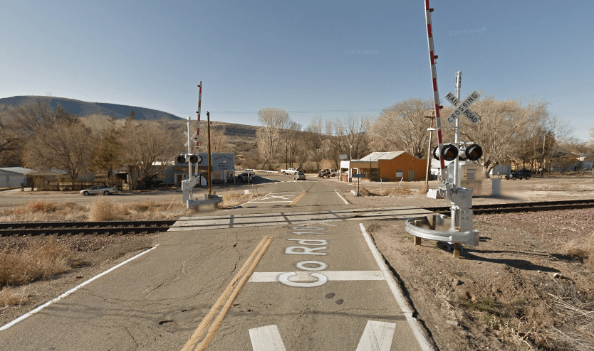
Growing up the Valley, I wondered why there are so many mid-century motels on Van Buren. It turns out that this is because it was once US 60. But US 60 wasn’t just Van Buren, it ran though much of the Valley. Today we’re going to see what’s left. First, some background. The US 60 was one of the early US cross-country highways. Starting in Virginia Beach, it at one point ran to Los Angeles, but was shortened to the route below in the 1960’s.
In the Phoenix metro, the route looked this. It ran down Main St. in Mesa, Mill in Tempe, and Van Buren in Phoenix before reaching Grand Ave. Much of Grand in the NW Valley remains as US 60, but through Central Phoenix and in the East Valley it has been replaced by more modern freeways. You can still find some remnants of when US 60 ran through these East Valley communities and that’s what we’re going to explore today. A lot of what’s left is preserved in the form of motels and signs, but there are some pieces of the road itself that give away its former use.Our first stop is in Mesa at the Buckhorn Baths Motel. Now dilapidated, you can get a sense of its former glory from the sign alone. Home to a natural hot spring, the motel hosted stars and athletes alike. It was built in the ‘30’s and ‘40’s by Ted and Alice Sliger and housed a huge taxidermy collection, in addition to its mineral baths. The Buckhorn Baths Motel was even the SF Giants home during Spring Training for a period. It was listed on the National Register in 2005.
Unlike the Buckhorn, there are several motels along the former US 60 in Mesa that are still in operation. Take the Starlite Motel, for example:
The Starlite may no longer have its pool, but it’s lovely neon sign, dating from 1960, stands proudly welcoming guests, though in 2010 the sign was damaged by a storm, and returned in 2013. Now in the middle of suburbia, you can see how rural the area was in this aerial from 1969. Just west of the Starlite sits the Deserama Mobile Home Park (what a name!). Another holdover from the days of the 60, this 55+ plus community was built in 1957. It also has this terrific sign: Closer to Downtown Mesa, the Kiva Lodge Motel is still kicking. It puts the motor in motel too, as it has carports for each room. With its caricature western architecture and less than appropriate sign, it really shows its age. But it also captures a different era clearly. As a side note, Main St. in Mesa is now home to Valley Metro Rail. In my mind there’s something poetic about the evolution of a street from a former US highway to a high capacity transit corridor. Light rail using the old US 60 for its alignment isn’t just poetic, it’s smart. The old US 60 route came from an era when highways didn’t bypass cities, the became main streets. In fact, the old 60 bisects Downtown Mesa, Tempe, Phoenix and Glendale in the Valley.You can really see that dynamic in this aerial from 1953. Look how the 60 serves as the spine connecting Downtown Tempe (left) and Downtown Mesa (right). There just isn’t much else out there!This brings us to the first piece of still-existing roadway design that reveals the old US 60 route. In Downtown Tempe at the intersection of Mill and Apache, there exists a curve in the roadway that would make no sense as a modern intersection design. That’s because it’s not! You can see that the curve appears as far back as aerials from 1937, though I don’t know the exact data of construction. Prior to the 60 this route was home to the Bankhead Highway, which left the 60 for Tucson along the AZ 79, west of what is today Apache Junction.This also brings us to the next section that gives away this road’s former highway status. After Mill Ave. crosses the Salt River, it briefly looks and feels a lot like a highway. It has an overpass and everything. You can see what I mean here:Again, returning to the historical aerials, this makes an appearance in 1959 photos. At the time, the 60 was the main road into Phoenix, so it makes sense that it would be rebuilt as a highway interchange to keep traffic moving. It’s a precursor to more modern interchanges in Phoenix. Moving into Phoenix as Mill changes to Van Buren, motels start reappearing as markers of the road’s past. Many of these are in worse shape than those in Mesa, like the Relax Inn, pictured here.From the Relax Inn we move to one of my favorite buildings/signs/pieces of history along the way. The Deer-O Paints building. This building dates back to 1958, when it was built by the Deer-O company, who made paints that could withstand the Arizona weather.You’ll notice that at some point the sign was changed to read “Salsa” instead of “Paint.” Apparently it was a salsa club at some point in its history and the owners, thankfully, left the wonderful Deer-O portion of the sign.
Now, as a paint factory from the 1950’s there’s a darker side to this lovely Art Deco style building. It was, in fact, a superfund site, though at this point it has been archived at this point. Let’s return to the aerials to see what it looked like in 1976. Notice the horseshoe building next door. You guessed it, that’s another motel. I’ll admit, staying in that motel seems less appealing than others, as it was next to a paint factory.
There is much more to explore than can be covered in a humble blog, but suffice it to say, driving along the US 60 is both a wonderful way to get across the valley and a bit of a trip back in time. Sources used for this thread include Maricopa County Historical Aerial Photography, real estate listings, http://RoadsidePeek.com, the Mesa Preservation Foundation, the David Rumsey Map Collection, Wikipedia, the EPA, and http://RoadsideAmerica.com.
This is lightly modified from a Twitter thread that covered the same topic.
Gather round friends, for today we are going to explore another special kind of subdivision in and around Phoenix. That’s right, today we’re going to dive way too deep into homes built around airstrips. For airplanes. (Yes, this is a real thing.)
First, you might be asking if this is a common thing. More than you’d probably think! Building a primitive or simple runway is not terribly difficult, so it’s not actually all that surprising that you can find these scattered around the country. Phoenix is a particularly good place to fly, with lots clear weather, so it’s even less surprising to find these here. Interestingly, these developments exist across a wide spectrum of available facilities, runway quality, and quite frankly, professionalism. So with the table set, let’s take a look at the airstrips and the homes that surround them throughout metro Phoenix.
First up is Hanger Haciendas (bonus points for a catchy name). As you can see, it’s fairly primitive. Located in South Phoenix, the runway is only slightly wider than a residential street. The homes themselves are large and as you’d expect, most have detached hangers for aircraft.
Hanger Haciendas is a private airfield and has some particularly, uh, interesting notes for Runway 26: “40 ft Power Line 532 ft from runway.” That’s right, you have to clear a power line before touching down from the east. There aren’t a lot of recent sales at Hanger Haciendas, but a 3/2 at about 2k sf sold for $565k in March 2020. The development was a product of the late ’80’s early ’90’s. Take a look at the plat map below.Finally, here you can see a section of the chart showing it in context. As you can see, it’s pretty close to South Mountain. I imagine that, unless you know where you’re going, picking out the runway among other residential streets might be somewhat difficult.
So you might be thinking that landing at a runway essentially the width of a residential street would be a challenge. But what if I told you that there are versions of this where the runway isn’t just the width of a residential street, it literally is the residential street! Let me introduce you to Thunder Ridge Airpark and Castle Well Airport, both in Morristown, AZ, NW of Phoenix. The runway at Thunder Ridge (pictured below) is also 237th Ave and the runway at Castle Well is 251st Ave. They are about 3 miles apart, as the crow flies.
As you can see, at both Thunder Ridge and Castle Well (pictured), the primary access to the residential homes is via the runway/road. I imagine that, given the width of the runway, some hairy situations could arise. “Bob, I’m trying to take off, don’t back out!” About the houses. As you’d expect, both have fairly large homes with hangers. Land can be had for about $100k, while a sale from 2019 had a 4/4 selling for about $460k. These are both from the late 80’s & early 90’s as well. These are pretty far from stuff – for example, the nearest grocery stores are in Wickenburg. So from Thunder Ridge, it would take about 1/2 hour to get to the Safeway by Wickenburg’s airport, which I’d wager, could probably be done faster by plane. Fly in fly out groceries!
Alright, let’s move on to some beefier airports with housing. The first, up in Carefree, is Skyranch at Carefree Airport (again, bonus points for a great name). This one really looks like an airport, more than the others we’ve looked at so far.
Skyranch is older than the others we’ve looked at, dating back to the 50’s, with direct runway access homes dating to the 60’s. As you can see, it focuses more on the airport than the housing, over 100 aircraft based there.
Interestingly, these homes can only be accessed by the appropriately named Autoplane Dr., which doubles as the taxiway from the homes to the runway itself. I can’t think of a more exciting way to drive home then along the taxiway at an airport. Unless it’s the runway, I guess. Anyway, these homes are not cheap. Recent sales of the single family homes off Autoplane Dr. have all been for $1 million+, which makes sense for this kind of home in a wealthy Phoenix exurb. If you’re interested, you can see the chart below as well.
Next up, we’ll explore the quite airport-y Stellar Airpark in Chandler, AZ. I drive by this every day on my way to work (shoutout Downtown Chandler, if you live in the Valley come on by!), so I’m a little more familiar with it.
Stellar Airpark is located in easily the most built up area of any of the ones we’ll see in this thread. You can see offices, regular subdivisions, the 202, etc. all around it. The freeway is a challenge in particular, as the light poles could become obstacles at takeoff/landing. To address this challenge, some pretty clever modifications were made to the lights at the South end of the runway along the 202. In the image below, you can see they’ve been lowered and have red beacons on top. It’s a neat detail that helps pilots. I can also verify that they’re still building at Stellar Airpark. The homes themselves have come in waves, some early ’70’s, some early ’00’s, and now some more today. The airpark itself was established in 1969. Interestingly, it’s also open to the public. So what do homes here cost? Well, as you might expect with such a wide range of construction periods, it depends. Recent sales range from $400k to $2+ million. Listings today are pushing $3 million. The difference here from others is that buyers have lots of amenities nearby. Additionally, there are commercial uses adjacent to Stellar, unlike the others which are purely residential or residential/recreational. This is, functionally, an airport. It just happens to also have taxi-up housing. You can see the chart below.The final one we’ll look at is Pegasus Airpark (aside: we should let the folks naming airports in Phoenix name more things! Sky Harbor, Skyranch, Pegasus, Thunder Ridge are all great). This one is down in Queen Creek, in the far Southeast Valley.Pegasus brands itself as “Arizona’s premier fly-in community” and I guess, who am I to argue with that? Activated in 1998, this one is more recent than the others we’ve seen. But, as you can tell, it’s still developing more than 2 decades on.Queen Creek is growing fast, and there are more and more amenities down there all the time. But back in the early ’00’s, this would have been way out there. What does this mean for cost? Lots w/ runway access sell for ~$250k, lots w/o ~$150k. Homes are ~$900k to $1+ million. Unlike Stellar, Pegasus is private. It’s interesting that not all lots have direct runway access and even some that could do not. This is fairly unusual for developments like these – I’m not sure I’d want to live on a runway if I didn’t fly. You can see the chart below. Now, there are A LOT of these – many more all over AZ and the country. These are ones that I find interesting and demonstrate the variety of builds. Many of these have their own website with more information, which I used for research, in additional to the following resources. Airpark Map dot com has developments like these mapped out all over the country. You can take a look here if you’re interested: https://www.airparkmap.com/home/arizona-airparks. I used Sky Vector for all of the charts (https://skyvector.com/?ll=33.208725,-111.617240278&chart=121&zoom=3…), Zillow for home prices, and the Maricopa County Assessors Site for plat maps.
This is lightly modified from a Twitter thread that covered the same topic.
Man-made lakes are a feature throughout the Phoenix metro area. Seriously, they’re everywhere. Notable then, yes, but unusual? No. There are, however, a subset of these lakes that I find fascinating & have been down the rabbit hole on: Man-made waterski lake housing developments. Now you might be asking any number of the following questions: What is that? Why does it exist? And in Phoenix? You said ‘developments;’ there are more than one of these? Who knew waterskiing was so popular in the desert? Fear not, because I wasted enough time to answer them all.
First, what is that? What is a waterski lake housing development? Well, it is, as they say, what it says on the tin. It’s a single family housing development centered on a waterski lake. And these things aren’t cheap! Houses in the photo above run from $500k to $3M+. Second, why does it exist? Well, as you may know, Phoenix has a lot of in-migration. The best guess I can hazard is that some well-to-do people moved to Phoenix and wanted to create a place where they could still waterski, but in a place devoid of places to do so, and well, water.
Now, I mentioned that there are several of these throughout the metro – many in far flung parts of the valley. See the photo below:
Let’s dive into each then. First, Lakeside Ski Village, located between Gila Bend & Buckeye. Evidently this one holds water ski events and has a bunch of onsite facilities. It’s also mostly built out, which is unusual for these developments. Houses appear to be weekend homes.
Second, Crystal Point Estates. This one is in Gilbert and is pricey! Almost all $1M+ here. Another one that is pretty well built out, but that’s less surprising because it’s in a wealthy, built up suburb. I’d also wager that these are primary residences.
Third, SanTan Lakeside Estates, also in Gilbert/Queen Creek, though on the fringes. This is the one from the first photo and is nearly built out. These are also very pricey and seem like they’re primary residences. On the fringe now, but I don’t think that they won’t be for long!Fourth, Buchli Lake Estates. It’s in the This one only has 3 of 9 lots built on and evidently was the first built. You can see that from the photo pretty clearly. It’s isolated in SanTan Valley and I suspect that it will stay pretty isolated for a while.Fifth (I can’t believe there are more): Playa Del Rey, also in Gilbert. Apparently this one doesn’t have a ‘competition’ ski lake. Interestingly, it also is the most focused on the housing part, as unlike others, it has houses not on the lake. <$1M and appear to primary homes.Sixth and final: Spring Mountain Ski Ranch. This one piqued my interest. It was established in 2005, so pre-recession, and no houses have been built there. Like so many other subdivisions in the metro, it wound up stillborn when the bubble burst.
Notice that it also has enough room for another lake. They were ambitious! Evidently a lot can be had for around $100k. It’s located on the lovely Old US 80 near the Historic Gillespie Bridge (worth the drive). I think, more than the others, this tells you about why these exist.
Okay, so here’s the thing, these are weird. But it’s hard to deny that there’s something appealing about the idea of living on a lake in the desert. That’s why there are so many other man-made lakes in and around the valley! Unlike those, I actually sort of respect that these are purpose-built. It’s not a feature of the development, it’s THE feature. So good for these folks. During this rabbit hole, I found out that there is an entire realty practice devoted to them, which is where I got a lot of this info: http://waterskiarizona.com/index.php.
In summation, I guess there’s no better place to waterski than the place that its notably devoid of water. Such is the way of development in Phoenix! Cheap land leads to a whole bunch of weirdness.