
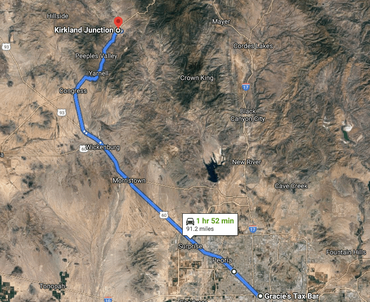
I took a day trip up to Prescott last weekend and as I was driving back, I started thinking about how we experience rural Arizona. Often, I think, we see rural Arizona from the Interstate or a large, fast highway designed to get you from point A to point B as quickly as possible. These roads bypass the small towns that the old highways connected, leaving us with less of an appreciation for what makes this state special. Don’t get me wrong, Arizona’s big highways are uniquely beautiful – the crests and valleys of the 17 especially so – but if possible, I think you should take the back road. Let me explain why by taking you on a journey along two of my favorite roads in Arizona.

Prescott is a favorite weekend getaway for Phoenicians. From its cooler temperatures to its charming downtown to its relative proximity, it’s easy to see why so many people make the trek up from the valley. In my experience, the most common way that folks get up to Prescott is via Interstate 17 and State Highway 69. I get why – it’s the fastest and easiest way to get to Prescott from Phoenix. But there is a better way. I now almost exclusively take the back way.
So what is the back way to Prescott? Well it’s really more like 1 ½ back ways, if I’m being honest, because while a majority of the route is shared, as you approach Prescott two options present themselves. The beginning is as follows for both: follow US 60 from Phoenix to Wickenburg and then take US 93 from Wickenburg to the junction with AZ 89. Once you’ve climbed the mountain and travel through the valleys, you have your choice of ways to get to Prescott – either AZ 89 straight through or County Road 10.
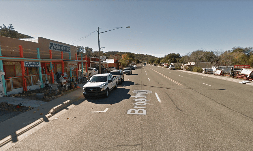
With that foundation laid, let’s talk about the first leg – the US 60 to Wickenburg. This heavily trafficked corridor also leads to Las Vegas, so you’re probably familiar with it. That said, I highly recommend stopping in Wickenburg’s absolutely adorable downtown. As US 60 turns into the US 93 it bypasses Downtown Wickenburg, so it’s quite possible you’ve missed it. But we’re not here to spend much time on Wickenburg – it’s a lovely place, but it’s also pretty well known.

As you take the turn onto AZ 89 near Wickenburg Ranch the traffic immediately thins and the desert opens up around you. Save for the occasional house, the first community you’ll encounter is Congress. There’s not much to see in Congress these days – but it has a pretty interesting history. The settlement that came with the Congress Mine, it is one of countless rural Arizona communities that emerged from the early days of mining.
Gold was discovered near congress in 1884, leading to the creation of the Congress Mine. The mine was active until the 1930’s, producing roughly $400 million worth of gold in today’s dollars during that period. In 1893, less than a decade after the discovery of gold, the Santa Fe, Prescott, and Phoenix Railway served the area. The rails are still active as the BNSF branch line to Phoenix. Unfortunately, much of the original Congress settlement is gone and what you see today is at the site of the former Congress Junction.

From Congress, the road turns northeast and approaches a spectacular wall of mountains. If you’re a fan of driving, this is where this route gets good. As you near the mountains, the road begins to climb and climb through beautifully contoured switchbacks that make for an excellent stretch of road. Paired with the stark contrast provided by the view of the desert below, it truly is one of my favorite pieces of asphalt in the state. It doesn’t hurt that the road climbs about 1,300 feet in about 4 miles either.

As you summit the mountain, you’re dropped into Yarnell, which is nestled in a small valley. Yarnell is, like Congress, a surviving mining town. Yarnell has fewer than 1,000 residents, and was founded to serve the Yarnell Mine. I can’t find much information about the Yarnell mine, but in recent history, the town is known for the tragic Yarnell Hill Fire, which killed 19 firefighters. There is a monument to these hotshots on the mountain near the town.
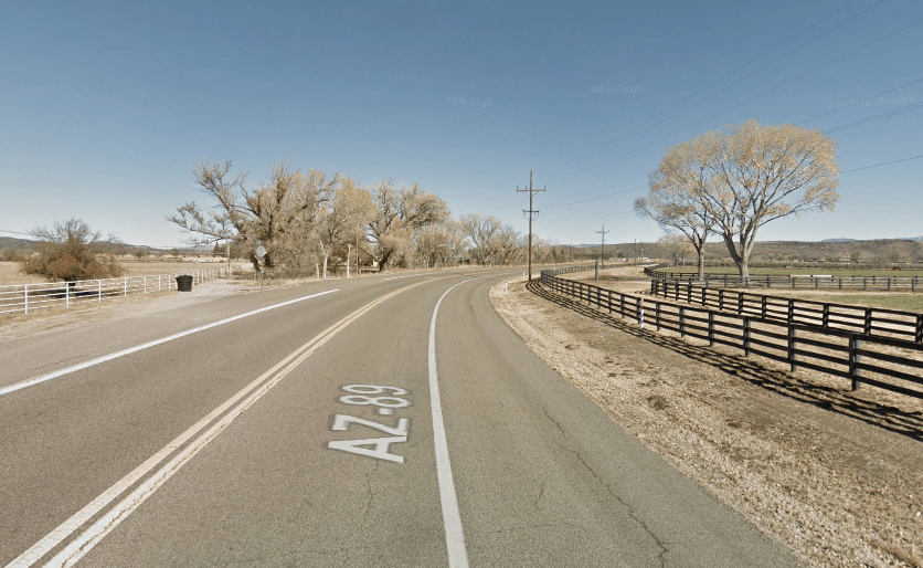
From Yarnell, you travel through the lush ranches of Peeple’s Valley. Passing through these agrarian landscapes reminds of what Arizona, and especially Phoenix, was once full of. It’s the kind of landscape that you’ll want to roll the windows down for so that you can take in all of the beauty. Named for AH Peeple’s, a prospector who discovered gold somewhat nearby, Peeple’s Valley, like the other towns on this drive, has a connection to mining.
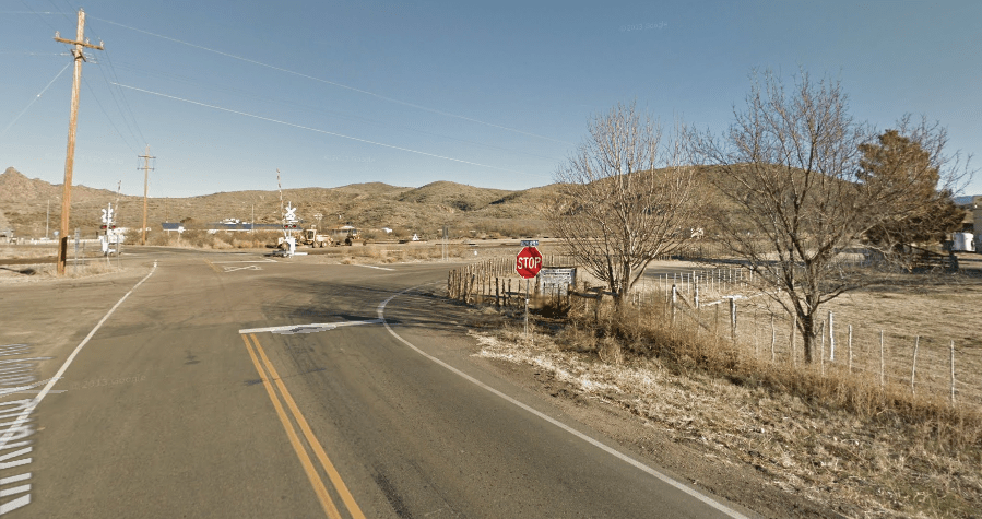
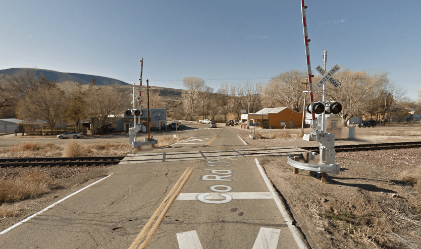
About 11 miles from Peeple’s Valley, at Kirkland Junction, you encounter your choice of ways to get to Prescott. Let’s turn down County Road 15 toward Kirkland and then turn right at the BNSF railroad track, which we’ll have crossed several times already and will cross again. As an aside, that the majority of this journey runs with the rails is something that enhances the experience significantly for me, as there’s something I find quite romantic about a freight train trundling alongside you as you drive through an empty expanse of rural Arizona. Or, in this case, as you pass through a little draw with a creek bed separating you from the rails.
You emerge from the draw into Skull Valley, a picturesque agrarian community of approximately 800 people. It has its own school district, post office, and is located along the same rail lines that we’ve passed before. Like Peeple’s Valley before it, Skull Valley is throwback to the agrarian roots of Arizona, a real time warp in a way. It’s easily one of the most beautiful places in Arizona. From Skull Valley, the road winds through more gorgeous Arizona country before entering Prescott on the northwest side of town.
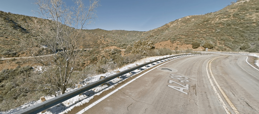
Returning to Kirkland Junction, this time we’ll continue on AZ 89 towards Wilhoit. Now, Wilhoit is a small rural town, just on the other side of the mountains from Prescott. Though there are only 16 miles between them, it feels as though they are worlds apart because the natural environments are so different. Additionally, though 16 miles is shorter than my daily commute to work, it takes about 30 minutes to from Wilhoit to Prescott, because AZ 89 again returns to being a series of switchbacks and hairpin curves – the kind of technical road that a driver loves.
All in, taking the back way(s) to Prescott adds about an hour to your journey, but what it lacks in efficiency it more than adds in beauty, exploration, and appreciation for what makes Arizona so wonderful. From sudden changes in environment to beautiful semi-isolated rural agrarian communities to interesting history, the back way(s) to Prescott provide a journey that is rich with the nostalgic magic of the road trip.
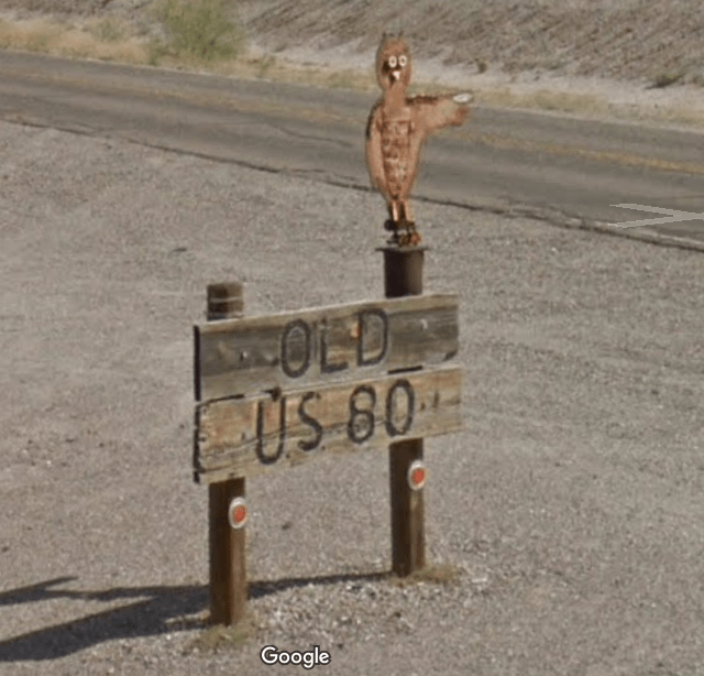
So now that we’ve explored the back way(s) to Prescott, I’d like to come back to Greater Phoenix – or at least Greater Phoenix by the standards of the Greater Phoenix Economic Council. We’ll be exploring how we get back to Phoenix from Gila Bend. For those that have driven to San Diego from Phoenix, the route you’ve likely taken is some combination of freeways, interstates, and State Highway 85 between the valley and Gila Bend. While that is undoubtedly the fast way to do it, I am here to tell you that it is not the best way. Instead, let me recommend Old US Highway 80 and MC 85 that eventually becomes Buckeye Road in Phoenix. And, as before, to explain why, I’ll take you through the journey.
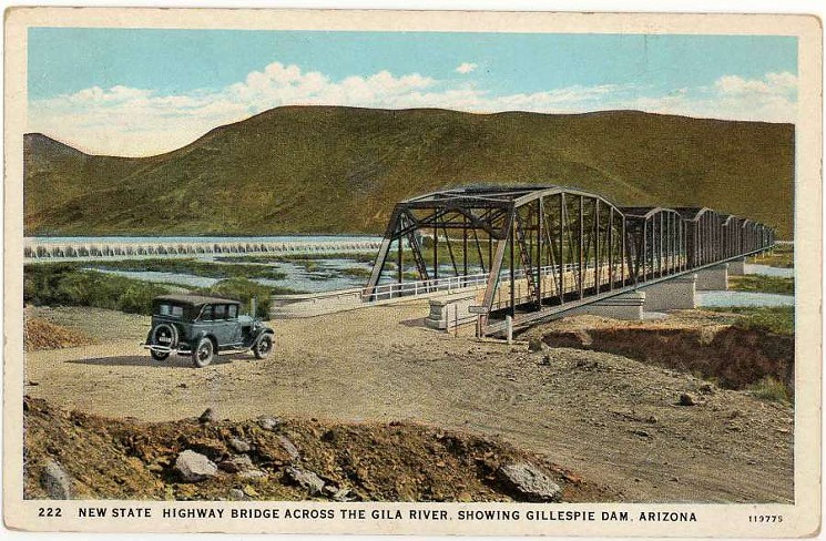
Starting from Gila Bend, Old US Highway 80 runs virtually parallel to State Highway 85 on the west side of the Gila Bend Canal. As you head north, Old US Highway 80 meanders through some of gorgeous agricultural landscapes before winding west to cross the Gila River. Here, we encounter our first true marker of this highway’s past: the Historic Gillespie Dam Bridge. We’ll explore the history of both the dam and the bridge below.
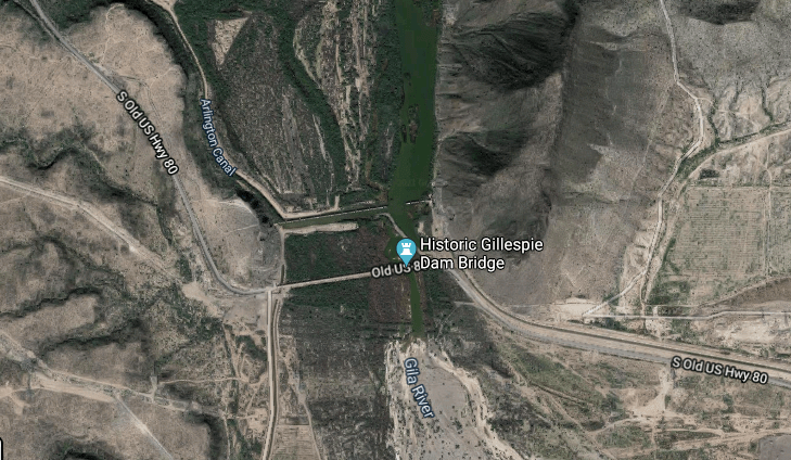
The Gillespie Dam was built by Frank Gillespie, a local rancher, and opened in 1921. It stood at 80 feet tall and spanned 1,700 feet and formed the Gillespie dam reservoir. It’s design was not like what you might see at Glen Canyon Dam in Page, but rather allowed water to overflow the dam when it rose to that level. Now, you’ll notice that I wrote the past several sentences in the past tense. I did so because in 1993 the dam failed during a major weather event, and was never repaired. What you’ll see along Old US Highway 80 today is more or less how the dam was immediately after its failure.

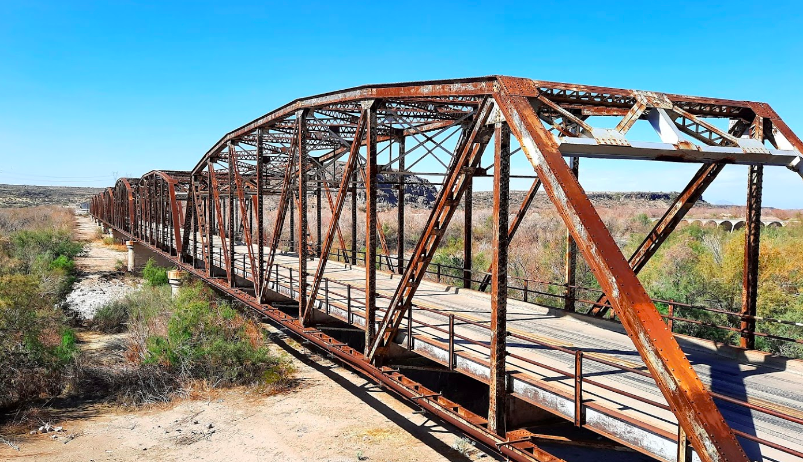
As you might imagine, very near to the Gillespie Dam is the Gillespie Dam Bridge, which was opened in 1927. Unlike the dam, the bridge still stands and is open to traffic. Interestingly, prior to the bridge’s construction, then US Highway 80 simply crossed the Gila River at the base of the Gillespie Dam, meaning that during storms, vehicles could struggle to cross. As an aside, I always find the early US Highways fascinating, simply because of how much more difficult traversing the United States was in the earliest days of the automobile. With this in mind, it should be no surprise that the bridge is remarkably narrow, with no pedestrian access on either side (not that it would really be necessary, if we’re being honest). The bridge was constructed with steel and was restored in 2012. There also appears to be some sort of historic information plaza, complete with parking, at the east side of the bridge, but when I last visited the bridge in 2020, the plaza was more or less destroyed.
It’s here that I want to take a moment to provide some background information on US Highway 80 for context. US Highway 80, known as the Ocean-to-Ocean highway, ran from San Diego, California to Tybee Island, Georgia. In Arizona, it ran from Yuma to Phoenix and back through Tucson – effectively Interstate 8 to State Highway 85 to Interstate 10 – before heading south to Tombstone before meeting the New Mexico state line. It’s worth noting that much of the tarmac that made up US Highway 80 in Arizona is still in use under some other designation. I highly recommend reading the entire wikipedia article on it and spending some time on Google Earth to see what’s left: https://en.wikipedia.org/wiki/U.S._Route_80_in_Arizona
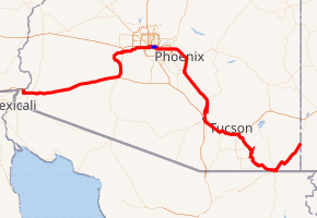
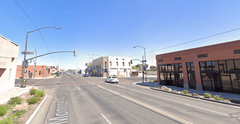
Returning to Old US Highway 80 on the west side of the bridge, the road continues to run alongside the beautiful green fields along the Gila River, before eventually bending back to the east in Arlington. There isn’t much to see in Arlington, but the scenery is lovely and it’s always interesting to see another small town. From Arlington, you can take Old Highway 80 to the current day State Highway 85 highway, but it doesn’t connect, so I’d recommend cutting over to MC 85, which will take you to Downtown Buckeye. You should stop in Downtown Buckeye and walk around, because it has a really interesting feeling of being both a part of the Phoenix metro and still quite rural.
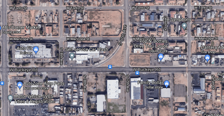
Stay on MC 85 and you’ll pass through a long swath of the remaining farmland in metro Phoenix and little agrarian towns like Liberty. You’ll also run alongside the Gila River for portions again, lending a natural beauty to the drive. As you approach Cotton Lane in Goodyear, you’ll suddenly find yourself back in civilization, near large warehouses, manufacturing, and other light industrial sites. Continuing on, you’ll eventually wind up near Phoenix Goodyear Airport, where MC 85 curves again and becomes Buckeye Road – aptly named, I’d say. I wrote earlier that a lot of US Highway 80 was still around under a different name, so it should come as no surprise that this entire portion of road was once a part of the highway. As we continue east, the road becomes less scenic, passing through what I’ll call distribution alley – a hive of trucks and trailers – before crossing Interstate 17. Soon after crossing the 17, US Highway 80 turned north on 17th avenue, where a physical remnant of the road remains today. If you read my write up on US 60, you’ll know that the Mill Avenue curve near ASU was a remnant of the old highway alignment. Here on 17th avenue, you can see that a similar curve exists.

As US Highway 80 headed north on 17th Avenue, it passed directly in front of the old State Capitol building before meeting Van Buren, where it turned east to stack with the US 60 (hello, old friend), at Grand Avenue. And because it joined there, this is where our journey will end.
Following the path of Old and now decommissioned Highway 80 is undoubtedly a longer, slower, and more cumbersome way to get from Gila Bend to Phoenix. But what should make it undesirable as a route actually has the opposite effect. This road transports you back in time, showing the roots (pun intended) of the valley in their agrarian glory. You’ll drive through history on the Gillespie Dam Bridge and see how the valley has transformed into the metropolis it is today – all on one road. Ultimately, this route is worth the trip because of how it moves you, not because of how you move on it.
This brings me to my final thought on why you, as an adventurous Arizonan, should take the back road. These roads put you back in touch with Arizona as it once was, which can in turn give you a greater appreciation of Arizona as it now is. The serene agrarian or desert landscapes they pass through can be a perfect canvas for your thoughts. They can show you why, in a very physical sense, early miners and ranchers came to Arizona in the first place and show you what happens when industry dies. And more than anything else, they can remind you why you love living in Arizona in the first place when the City becomes overwhelming. They certainly do that for me.
Sources for this include Wikipedia, MrZip66, Google Maps, Tucson.com, Maricopa County Historical Aerials, and Gila Bend, AZ.
